Understanding the Fire Needs Assessment Methodology
This assessment followed a modified protocol from a 2014 Wisconsin Fire Needs Assessment (FNA) (Hmielowski et al, 2016). The 2014 FNA developed an approach for prioritizing land management activities, specifically prescribed fire, taking into consideration potential ecological benefit, feasibility, and effort required to achieve desired benefits. The basis for vegetation cover and fire dependency utilized LANDFIRE program models.
The LANDFIRE project produces several landscape-scale model products representing vegetation, fuels, fire regimes, and disturbance. The primary data products used in the FNA include the Biophysical Settings (BpS) and Existing Vegetation Type (EVT) layers. The BpS model describes reference conditions, or how ecosystems (1300+ across the US) looked prior to European settlement. Each ecosystem is described by succession classes, species composition, and structure. Derived from the LANDFIRE vegetation dynamics model, the BpS layer predicts fire return interval, percent of low-severity, mixed-severity, and high-severity fire, and fire regime groups (LANDFIRE 2021). In the FNA, we use reference condition fire regime information to predict fire regimes for current like-ecosystems
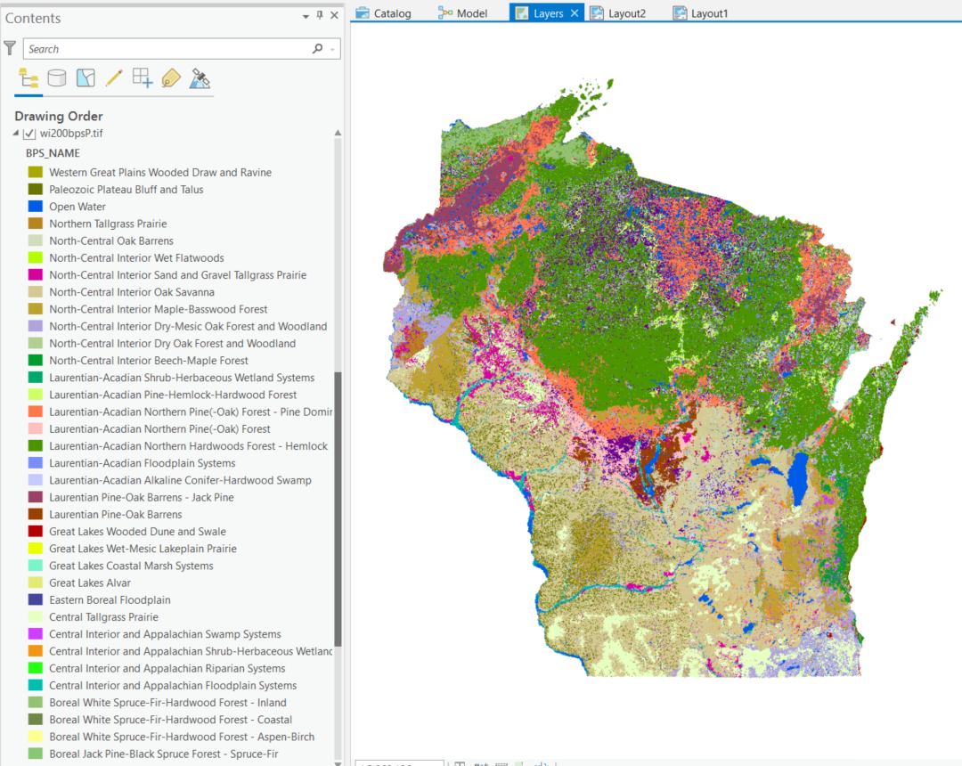
Biophysical Settings layer ecosystems clipped to the Wisconsin state boundary, as viewed in ArcGIS Pro
The LANDFIRE EVT layer represents the current distribution of terrestrial ecosystems as determined by a model with inputs including Landsat imagery, elevation, biophysical gradient data, field data, and decision tree models. The EVT model vegetation types are based on NatureServe ecosystem classifications. Additionally, ruderal and semi-natural vegetation types are based on the US National Vegetation Classification.
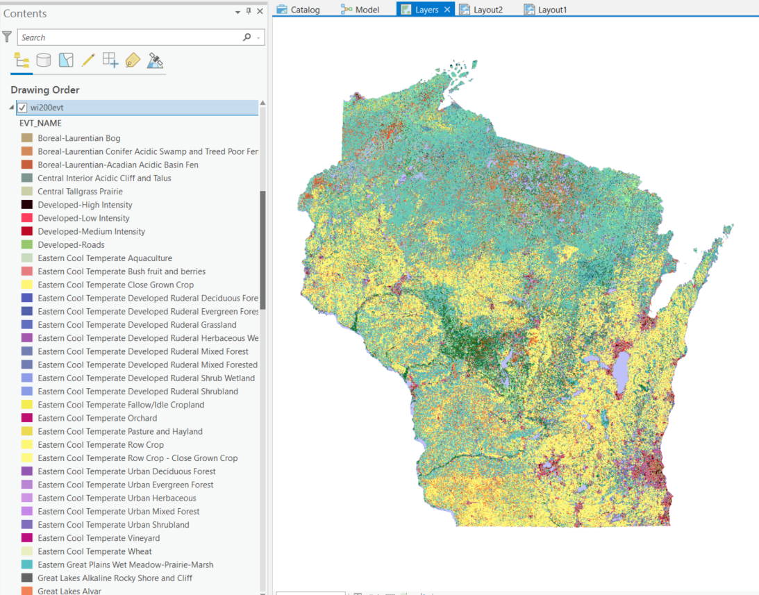
Existing Vegetation Type layer ecosystems clipped to the Wisconsin state boundary, as viewed in ArcGIS Pro
A 2016 “Remap” updated and enhanced LANDFIRE model products used in the 2014 FNA, therefore justifying a re-assessment of Wisconsin’s fire needs.
Crosswalk Process
A spatial representation of fire-dependent vegetation was generated by modifying the LANDFIRE EVT model to reflect our current understanding of Wisconsin plant communities. Fire regime information for current fire-dependent vegetation was gleaned by crosswalking existing vegetation (EVTs) to historical vegetation and historic fire regime information from LANDFIRE BpS model. The crosswalk process, therefore, joins three layers of information: existing land cover (EVT model output), associated Wisconsin Natural Plant Communities (as defined in the Natural Heritage Inventory), and fire regime information sourced from historical ecosystem fire regime model (BpS).
The crosswalk process is subjective and requires application of scientific literature and expert feedback to create a final data layer that accurately reflects our current landscape and our knowledge about plausible fire regimes. An initial iteration of this 2021 FNA provides an estimation of current fire needs with no modification of fire regime attributes as sourced from the BpS model, other than careful consideration in pairing current vegetation types (EVTs) to appropriate historical reference communities (BpSs). Read more about the crosswalk process in the protocol documentation. A brief description of a participatory crosswalk process used in Illinois’ FNA is detailed in (Hagen 2016). Future iterations of the 2021 FNA will incorporate stakeholder input in modifying estimating fire regime attributes.
Ecological benefit, effort, and likelihood of management success were evaluated using the Wisconsin Department of Natural Resources (WDNR) Natural Heritage Inventory State rarity rankings, WDNR-designated conservation opportunity areas, and wildland urban interface.
A Template Fire Needs Assessment
The 2014 FNA protocol applied existing national datasets, allowing the protocol to be replicated to any region of the United States. This re-assessment furthers the original goal of the 2015 FNA to provide a template for future fire needs assessments. This website serves as an accessible step-by-step guide to replicating and modifying the fire needs assessment protocol for your specific area of interest. To improve the efficiency of performing a fire needs assessment, I implemented the ArcPy package in ArcGIS Pro to write a repeatable Python workflow. Data manipulation and summarization additionally utilized R scripting in RStudio.
Follow the step-by-step (Forthcoming)
Access scripts on github.
Webpage produced by Stacey Marion, August 2021