Draft
Quantifying our state's fire needs
This assessment quantifies the state of Wisconsin’s fire “needs”, or the amount of prescribed fire needed to conserve fire-dependent natural communities in Wisconsin.
Government agencies, conservation nonprofits, private contractors, volunteer groups and private landowners all play a role in the resilience of Wisconsin’s natural lands. The intricate mix of players presents a unique challenge to implementing conservation at the scale required to meet climate resilience. Since many of Wisconsin’s natural plant communities are fire-dependent, prescribed fire is a critical component of meeting conservation goals in the future.
This assessment serves as a benchmark for the conservation community to quantify the gap between current fire application and needed fire application in the State of Wisconsin.
This assessment provides an update to the 2014 Wisconsin Fire Needs Assessment (Hmielowski et al, 2016). The assessment seeks to quantify current prescribed fire needs, and offer an approach to prioritizing application of prescribed fire based on ecological benefit, feasibilty, and management effort. The fire needs assessment utilizes national-wide datasets, such that the Wisconsin fire needs assessment can be used as a template for fire needs assessments in other regions of the United States. Read our methodology for a step-by-step guide to performing the fire needs assessment, and to access associated scripts.
Learn more about why we burn, and about the Wisconsin Prescribed Fire Council's mission to support burning in the State.
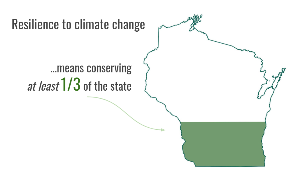
Putting our current needs in context
The conservation community generall accepts a goal of preserving 30% of land for conservation in order to meet climate resilience and protection of critical biodiversity. (see Saving 30x30)
Wisconsin's historical landscape
Wisconsin historically (pre-European settlement) supported over 40 diverse ecosystems.
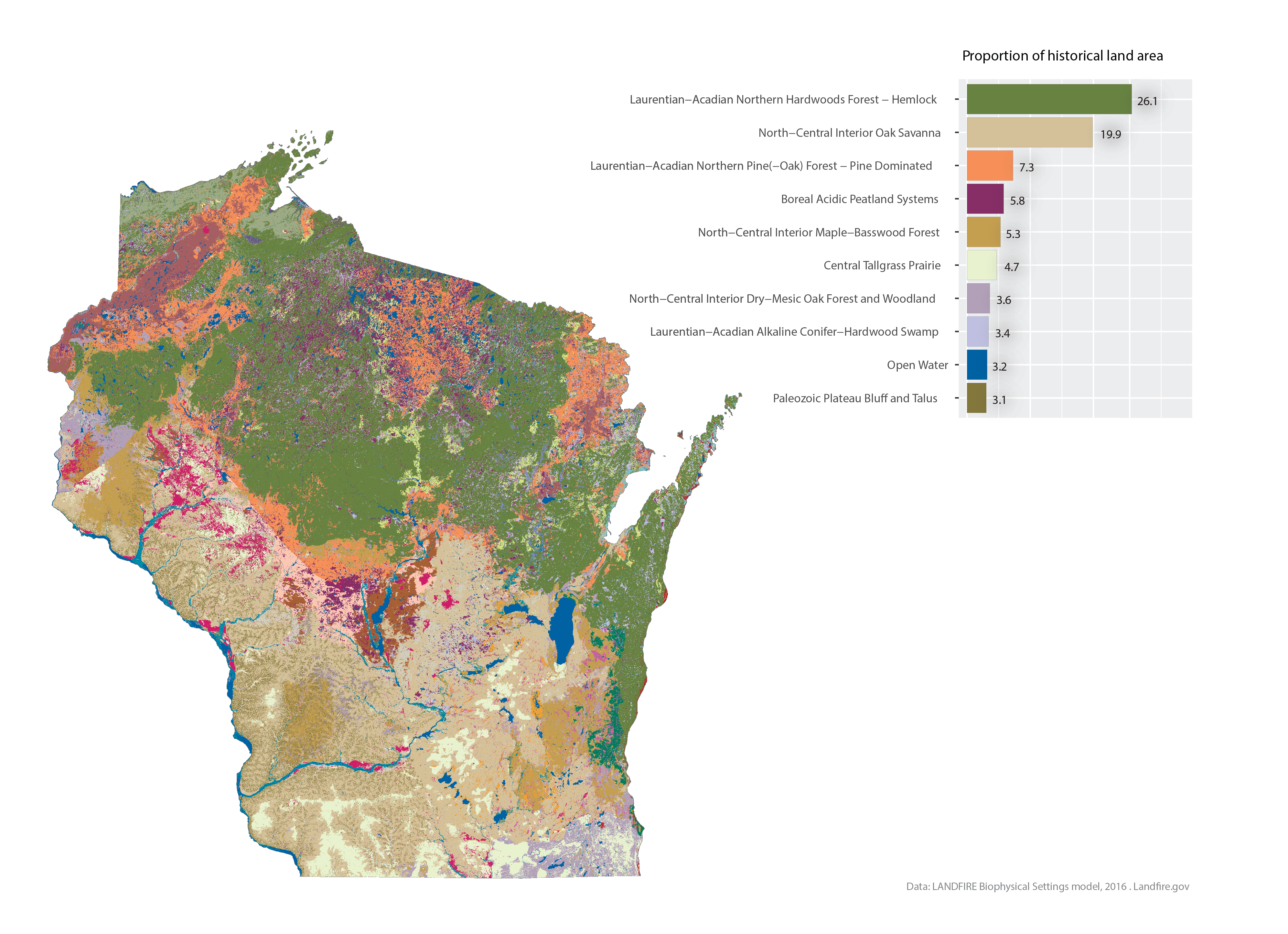
Many of Wisconsin's natural communities experienced frequent fire, either by natural ignitions or anthropogenic sources. Generally, the south/west experienced relatively frequent fire, whereas the north/east experienced relatively infrequent fire; demonstrating an ecological divide locally described as the tension zone. The south and west portions of the state were predominantly covered by prairie and oak savanna, where individual patches burned every 1-5 years.
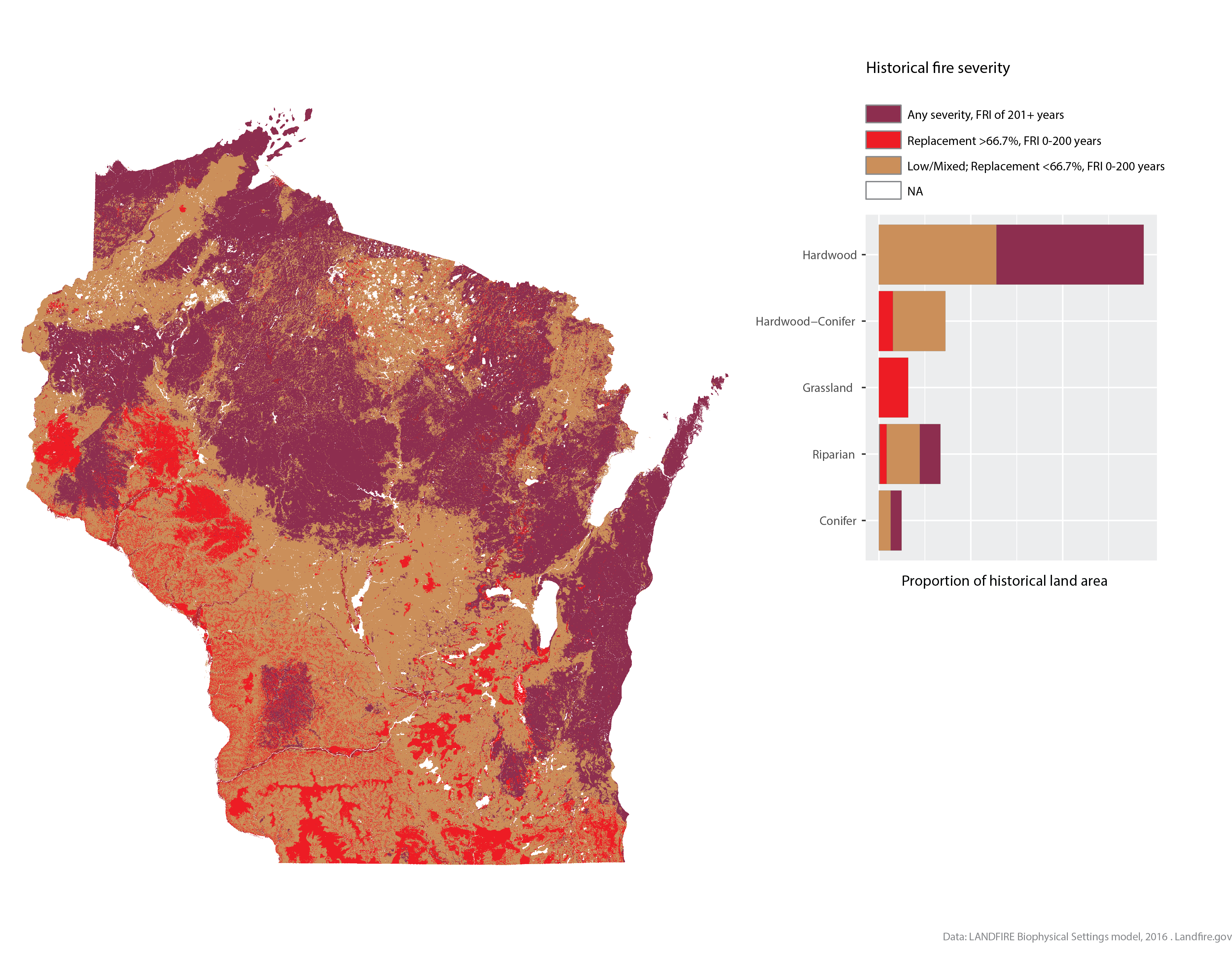
Fire severity is measured as the percent of above-ground biomass killed following a fire. A low-severity fire is defined as less than 25 percent average top-kill for a given vegetation type; mixed-severity as between 25 and 75 percent top-kill; and a replacement fire as greater than 75% top-kill. Fire severity is not a proxy for fire intensity, which describes fire behavior such as rate of spread or flame length. Fire severity, as defined by LANDFIRE, measures the mortality of a fire. A fire consuming 80% of the above-ground fuels in a grassland would be considered a “replacement” fire. A fire consuming 80% of grasses within an oak forest, but only killing 20% of the total above-ground biomass for that ecosystem, would be considered a low-severity or “surface” fire.
Across Wisconsin, typical fire severity ranged greatly depending on ecosystem type. The high prevalence of replacement fire in the southwest part of the state was attributed to grassland communities, where the majority of grass fuels were consumed and killed during a burn.
Forested areas experienced fires of all severities, with conifer-dominated communities more likely to experience replacement fires, and hardwood-dominated forests more likely to experience surface fires.
Across all communities, the most commonly occurring fire type were fires of low or mixed severity, i.e. surface fires.
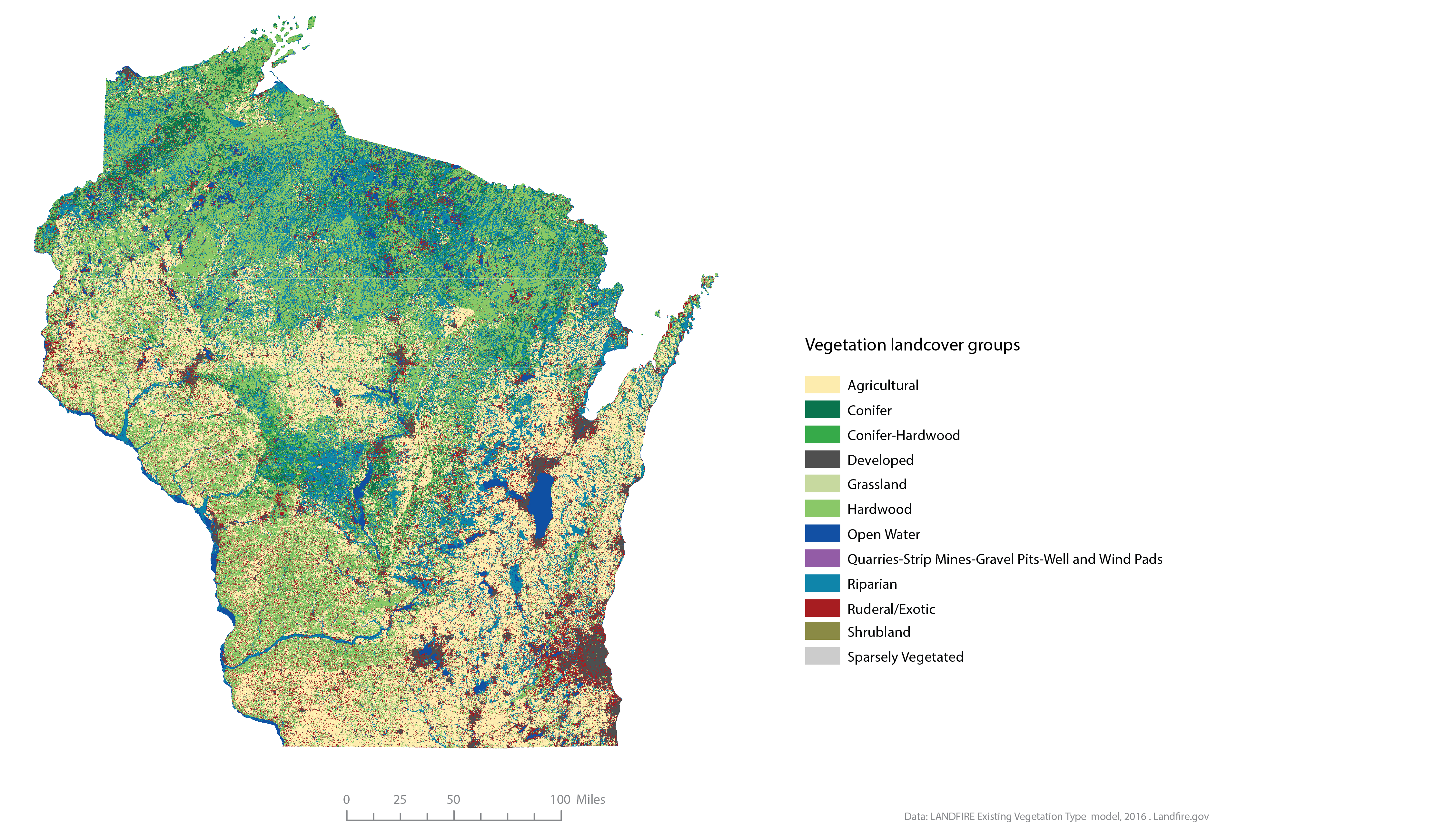
Today's landscape
Wisconsin’s landscape has dramatically changed due to human pressure on the landscape including agricultural land use, logging, development and urbanization, and hydrologic modification, primarily in the last 200 years.
Despite these impacts, nearly 58% of Wisconsin land retains natural plant cover. Many natural communities, however, are severely degraded (departed from historical biodiversity) due to indirect human impacts including invasive exotic species, suppression of historic fire regimes, change in hydrology, livestock grazing, and loss of diversity due to direct and indirect effects of climate change, among other impacts. Reintroduction of ecological processes, such as fire, offers one of the most effective management strategies for restoring biodiversity back to Wisconsin's natural communities.
Today's fire needs
Wisconsin's current fire regime estimates are mapped by associating a current natural community to the historic community it most resembles. The crosswalk process is imperfect, as some current natural communities retain little resemblance to historic communities due to degradation. These changes in composition mean that historically fire-dependent communities may include a larger proportion of fire-intolerant species (a process called mesiphication, a result of fire suppression), and in our model, the fire regime would reflect this lower dependency on fire.
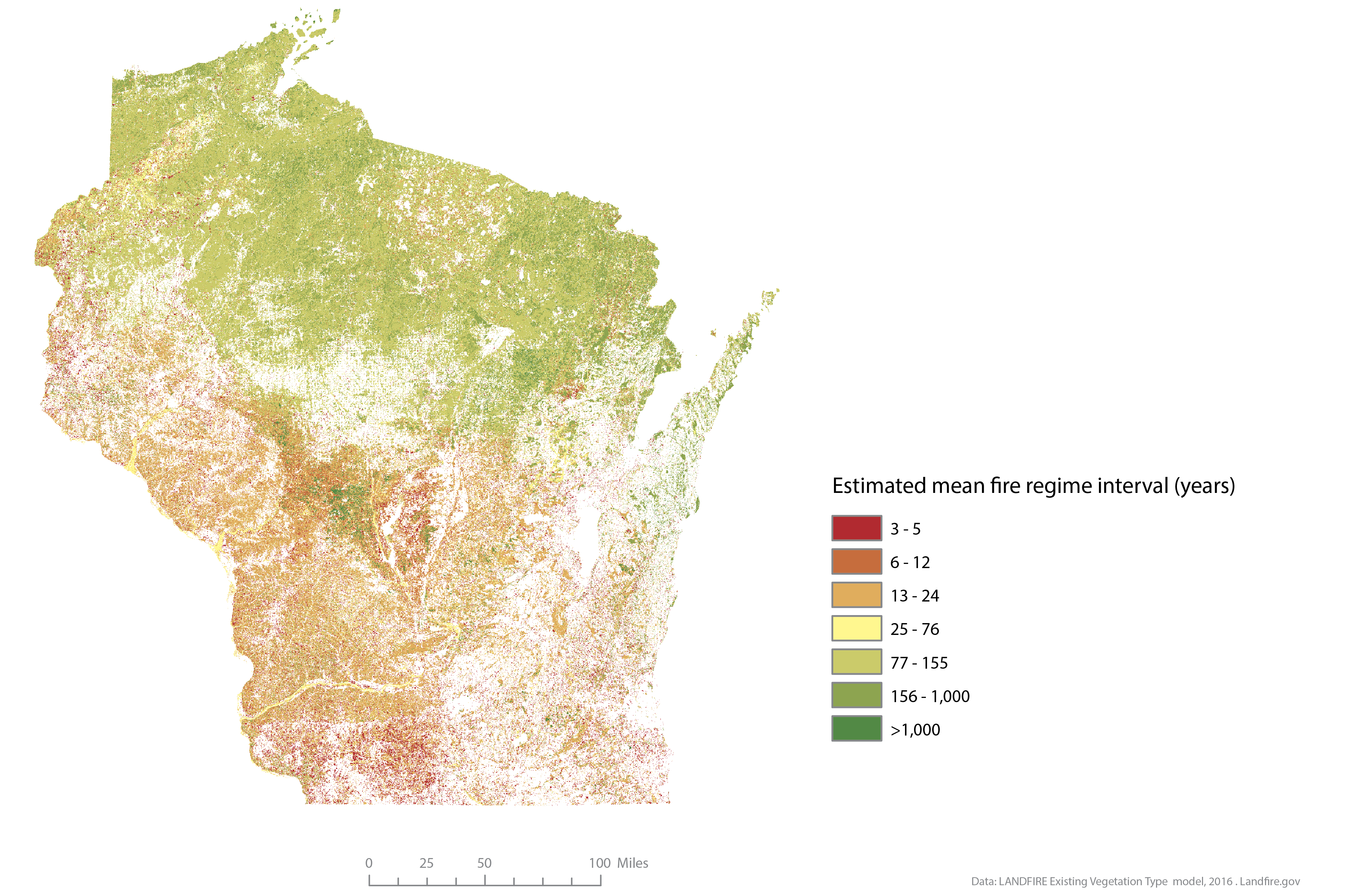
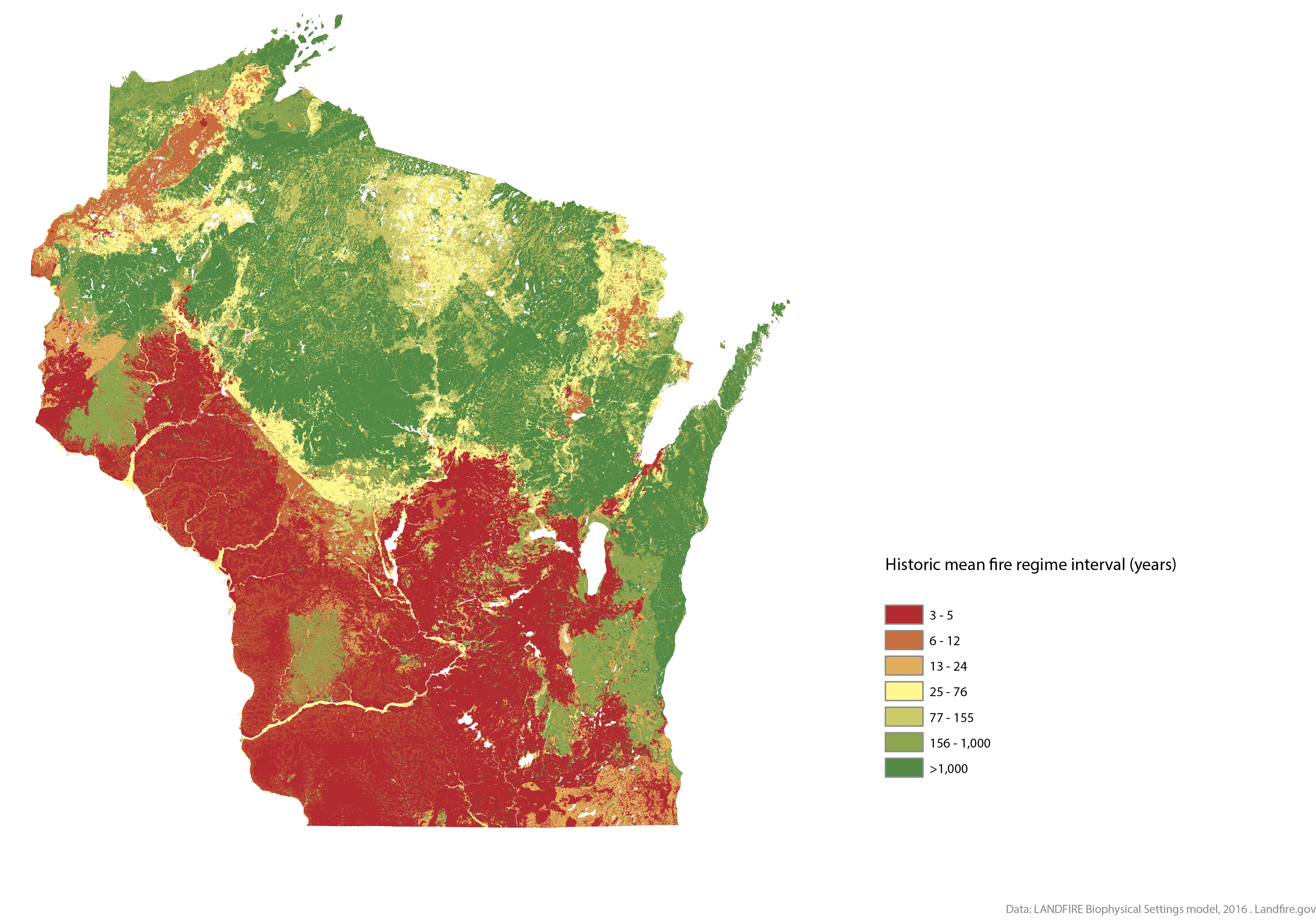
Areas requiring frequent fire include grassland and prairie communities.
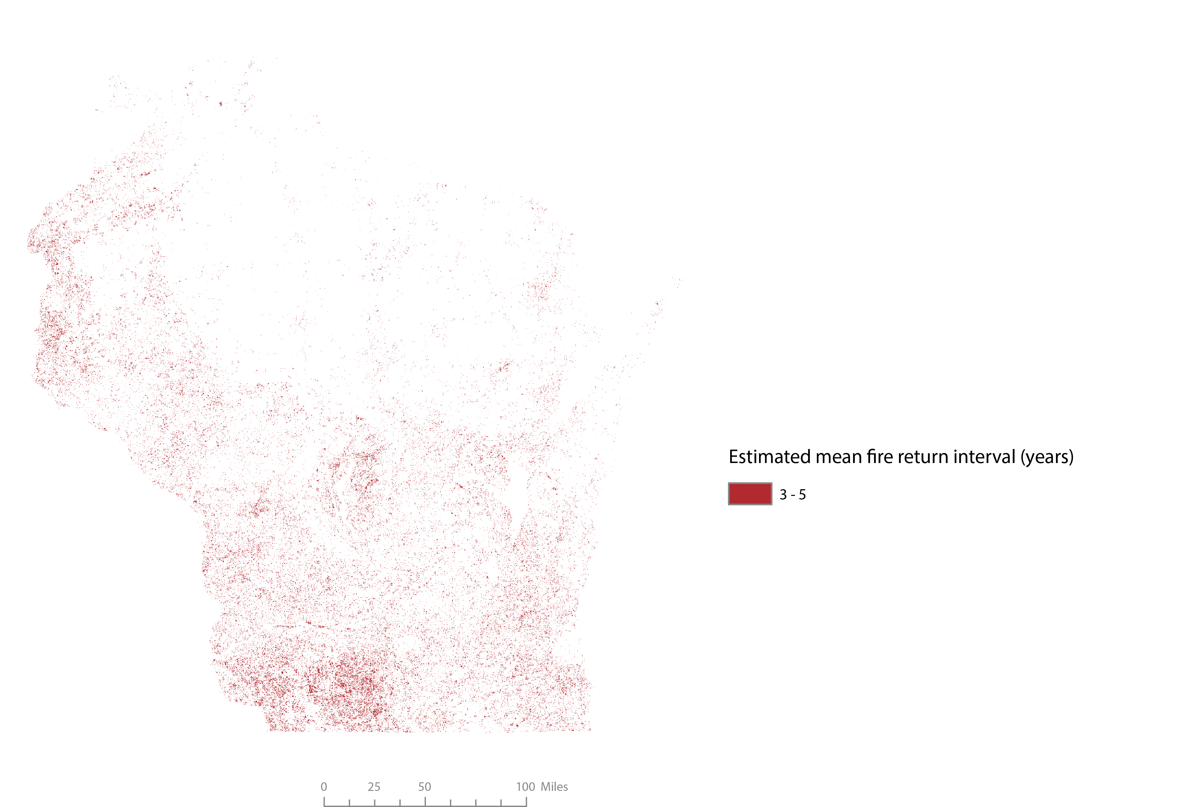
Areas with an unmodified fire return interval of 5 years or less on average.
Pine-oak forests, pine barrens, and forested bluffs require burning every 6-12 years on average.
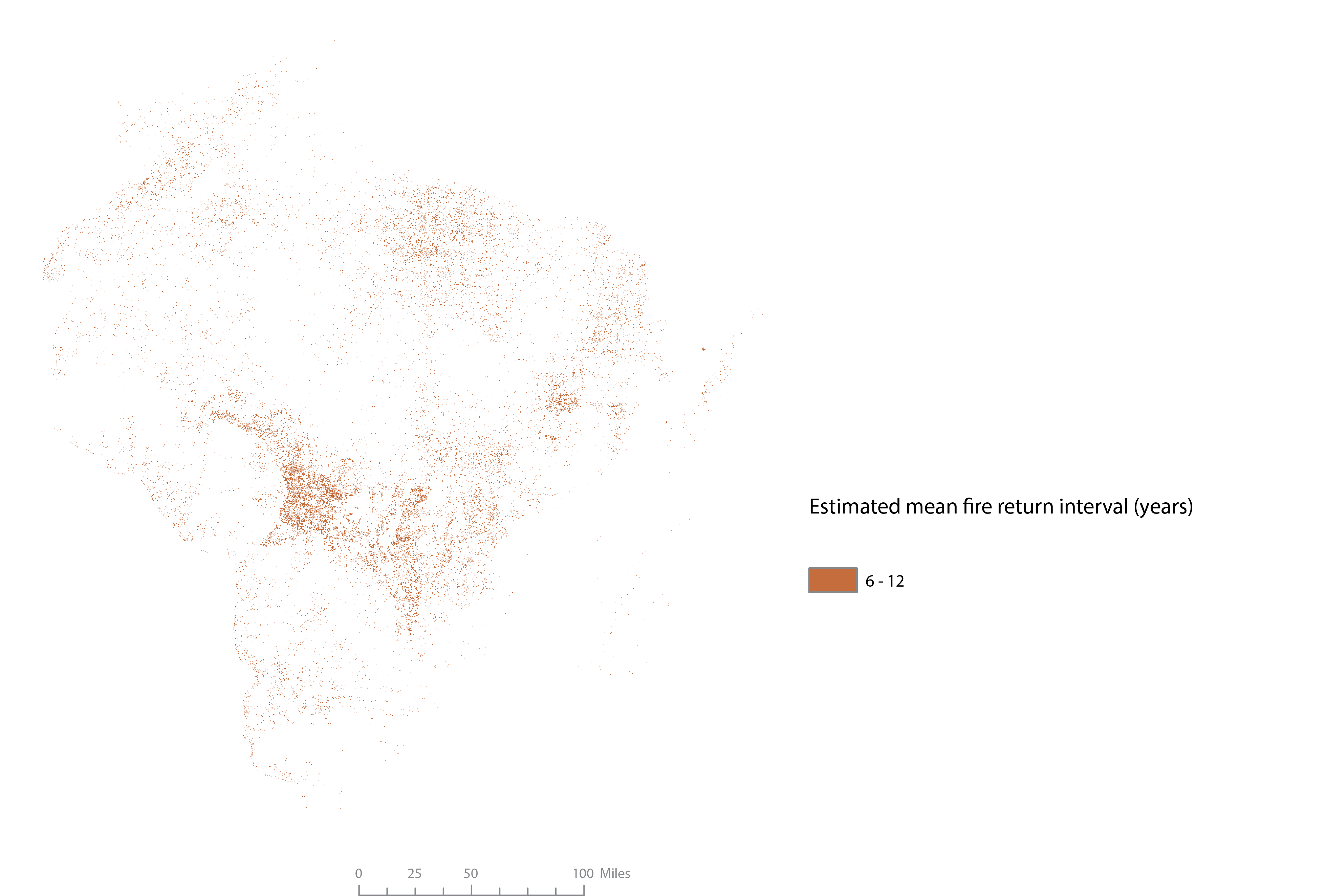
Areas with an unmodified fire return interval of 6-12 years.
Areas of intermediate fire frequency (13 to 24 years) include southern dry forest, and wetland communities including sedge meadow, shrub-carr, alder thicket, and calcareous fen.
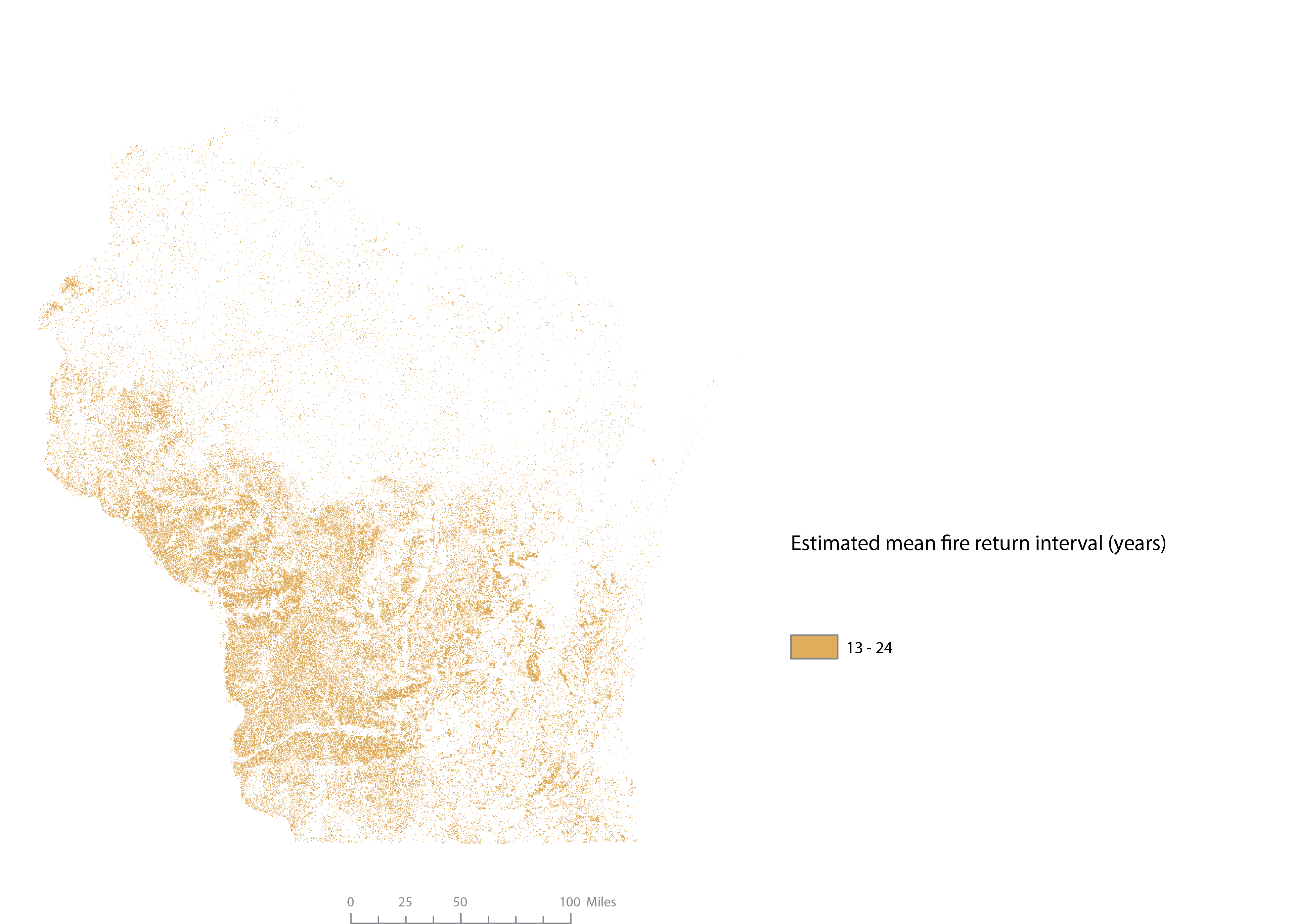
Areas with an unmodified fire return interval of 13-24 years.
To maintain the current extent of natural area, we estimate over 900,000 acres burned annually. Managed grasslands and ruderal grasslands constitute a large opportunity for habitat restoration. However, management with prescribed burning should be evaluated within the context of other management practices already occurring, such as managed grazing and mowing. Following grassland communities, forest communities offer a large prescribed fire need by acreage despite moderate fire return intervals. Dry-mesic oak forests, for example, have an estimated mean fire return interval of 24 years, but due to its vast abundance on the landscape, requires an estimated ~100,000 acres burned annually to mimic historical burn frequency. View a complete table of estimated annual burning needs by vegetation type. (Forthcoming)

(Forthcoming) Vegetation types with the largest annual fire needs by acreage (highest ten).
While estimations of prescribed fire needs are helpful in understanding the relative magnitude required to sustain natural communities, the LANDFIRE model products are, “not a prescription for how things should be today or tomorrow” (Hagen 2016).
Conservationists strive to restore natural communities to more closely resemble historical composition when the historical composition provides greater biodiversity. Future revisions of the Fire Needs Assessment should incorporate expert opinion and best able science to better predict current fire regimes needed to restore natural communities.
Future Analysis
Further analysis will help prioritize where best to apply fire. Application of prescribed fire can be prioritized based on potential ecological benefit. On a landscape scale, we can consider ecological rarity as a metric of how endangered a community is. By identifying communities with high rarity and frequent fire return intervals, we can determine the communities that are most threatened by fire suppression.
After determining the highest priority areas for prescribed fire application for ecological benefit, we will incorporate the effort and feasibility of performing prescribed fire. Management effort captures resources needed to adequately manage frequently burned vegetation by considering the number of individual units (patches of fire-dependent vegetation) and the required number of fire applications. Feasibility of prescribed fire application considers proximity of fire-dependent patches to developed areas, assuming that patches closer to developed areas have a lower probability of successfully maintaining ecological value. By combining indices of maximum ecological benefit, management effort, and management feasibility, we will present a comprehensive prioritization scheme for prescribed burning application.
Webpage and assessment produced by Stacey Marion, August 2021